
Geographical atlas of Colombia
Географический атлас Колумбии
- Publication
- Известия Академии наук СССР. Серия географическая
- Issue
- 5
- Pages
- 110–117
Colombia
1967–1969View whole-article summary
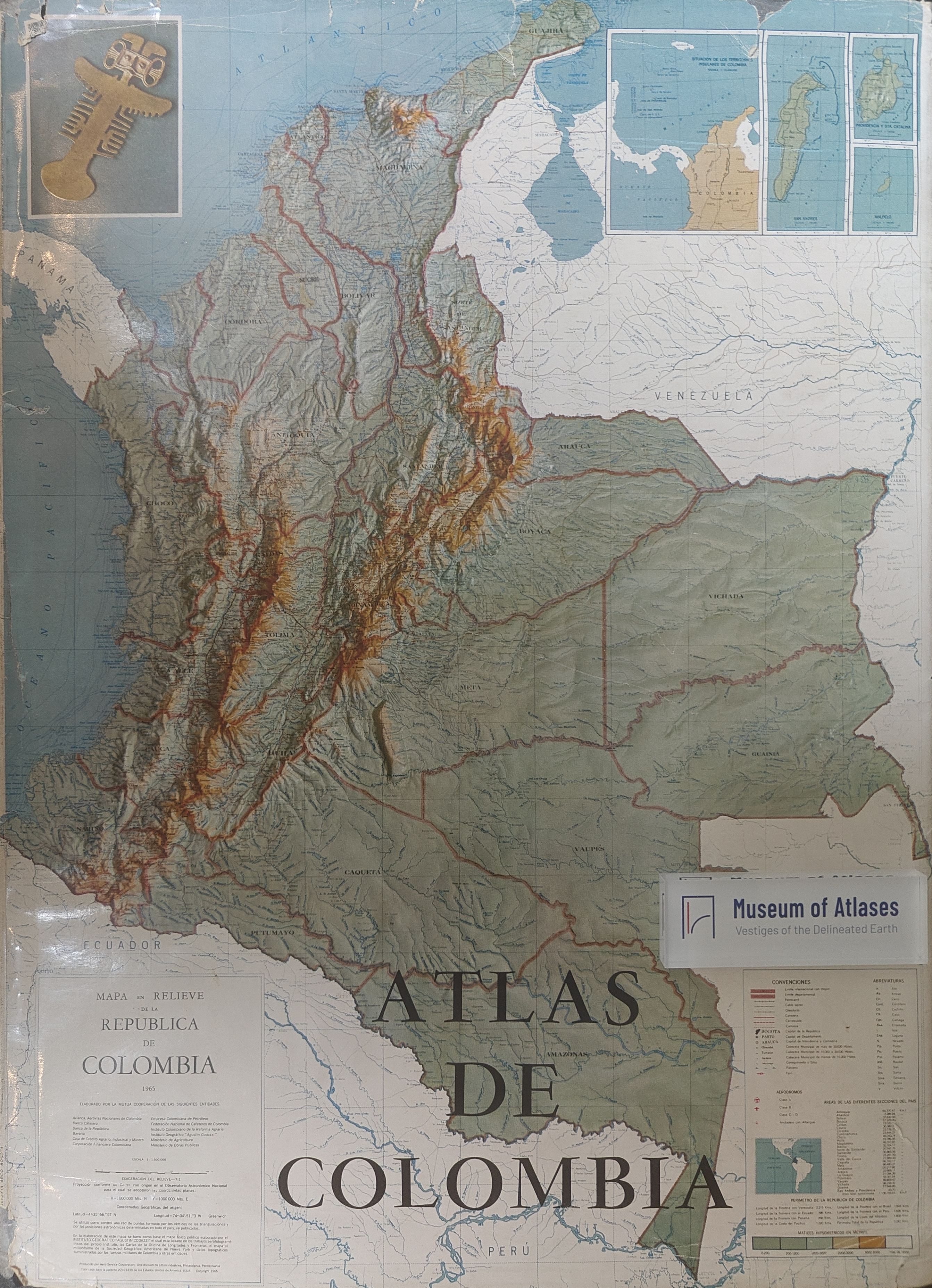
This article reviews the second edition of the Atlas of Colombia, published in 1969 by the Agustín Codazzi Geographic Institute, and situates it within the broader Latin American movement to produce comprehensive national atlases during the 1960s. That movement was closely connected with the need to inventory, evaluate, and rationally use natural and labor resources. Prepared with the participation of several Colombian scientific, governmental, and financial institutions and informed by recommendations of the International Geographical Union’s Commission on National Atlases, the volume contains a geographical description, 169 maps—including 23 city plans—extensive photographs and diagrams, and an index of approximately 5,200 place names. Its thematic range encompasses cosmography, cartography, historical development, physical geography, population and culture, economic activity, transportation, administrative divisions, and general maps of departments and territories. Facsimiles of early maps, materials on the settlement and culture of the Chibcha, and representations of conquest, colonial rule, independence, and state formation illuminate both Colombia’s cartographic heritage and its historical evolution. The physical-geographical section includes paleogeographic, geological, seismotectonic, climatic, soil, and related maps. Climate receives relatively detailed treatment, particularly the relationships among altitude, thermal zones, precipitation, settlement, and crop distribution. By contrast, geomorphology, hydrology, runoff, soils, and oceanographic conditions are inadequately represented, reflecting uneven levels of scientific investigation. Economic maps portray mineral resources, petroleum concessions and infrastructure, electric power, industry, and agriculture. They reveal the role of foreign companies in petroleum exploitation, the structure of industrial employment, and the spatial distribution of coffee, bananas, and other major crops and livestock. However, important subjects such as land ownership, land use, agrarian reform, trade, and finance are omitted. Transportation maps show road, railway, river, maritime, and air networks, as well as proposed routes, but lack information on ownership, traffic flows, port hinterlands, and freight and passenger volumes. The reviewers also criticize small map scales, misleading placement of pictorial industrial symbols, unexplained economic regionalization, schematic relief representation, incomplete legends, and other editorial errors. The second edition expands the atlas mainly through astronautics materials, additional photographs, improved color design, and updated statistics rather than substantial cartographic revision. Despite these shortcomings and the limitations imposed by incomplete surveys, the atlas provides an accessible and broadly comprehensive portrayal of Colombia’s history, environment, population, economy, and culture. Its visual design, effective color selection, original symbols, rich illustrations, and high production quality give it considerable scientific, educational, cultural, and popular value.
Related Atlases
Comments
Loading...
0/2000